← Relocating to NC Jones
Central Coast · County guide
Jones County, North Carolina
“A small inland county on the Trent River, outside the CAMA coastal counties, where the flood gauges at Trenton and Pollocksville and large forest tracts shape a purchase.”
 By Travis Old, broker and builder. Drafted with Melinda, an AI assistant. How we write
The full Jones County Buyer’s Brief site is not live yet. This page is a county guide in the meantime; listings and the full county briefs arrive with the site.
Horizon Realty Group helps with a search in Jones County directly or through its agent referral network. Travis Old stays your point of contact.
Jones County is a small inland county of the coastal plain on the Trent River, with Trenton as the county seat and Pollocksville and Maysville as the other towns on the state's rate table. Two large forest tracts lie in or across it. The Forest Service's recreation page says the Croatan National Forest spans Craven, Carteret and Jones counties and gives up to 167,687 acres for the forest as a whole, not Jones County's share. NC State's College of Natural Resources says Hofmann Forest covers 79,000 acres in Jones and Onslow counties, is privately owned and is not open to the public. The state's licensed-hospital list, dated March 5, 2026, shows no hospital in Jones County. G.S. 113A-103 defines the Coastal Area Management Act's coastal area as counties the Governor designates under the statute's standards, and the 20 counties it lists by way of illustration as designated on July 1, 2012 do not include Jones.
Property tax is the county rate plus a town rate inside town limits. The towns on the state's table are Pollocksville, Trenton and Maysville, and county fire districts add a further line outside the towns. Current county, town and district rates are in the table on this page.
At a glance
- County property tax rate (FY2026-27)
- $0.74 per $100before any town rate
- Coastal (CAMA) permit county
- No
- Financing reference
- Conforming loan limit, one unit (2026)
- $832,750
- FHA loan limit, one unit (2026)
- $541,287
Tax rate: NCDOR, verified November 12, 2026; town rates and any district rates on file are in the table below. Loan limits: FHFA and HUD, verified November 3, 2026.
The Trent River sets the flood record, and the National Weather Service publishes it by gauge. At Trenton (TRTN7) the flood categories are 12 feet for action, 14 minor, 19 moderate and 24 major. The highest published crest is 29.28 feet on the night of September 16, 2018, during Hurricane Florence, ahead of 28.42 feet on September 19, 1999 and 23.77 feet on October 10, 2016; the August 12, 2024 crest was 20.8 feet. At Pollocksville (PLLN7) the categories are 3.5, 4, 7 and 11 feet, and the highest published crest is 20.48 feet on September 18, 2018, ahead of 16.29 feet on September 19, 1999 and 8.5 feet on October 13, 2016. The Weather Service's impact statement for 20 feet at Pollocksville reads "Catastrophic flooding along the river in and around Pollocksville" and calls it comparable to the flood following Hurricane Florence. FEMA's Community Status Book, read November 11, 2026, lists the unincorporated county's flood map as effective January 17, 2025, Pollocksville's as June 15, 2022, and Trenton's and Maysville's as February 16, 2006. Neither the county nor its towns appears on FEMA's Community Rating System list effective October 1, 2026. The county's Inspections page links its Flood Damage Prevention Ordinance, 2023 update, and a floodplain development application. Check each parcel in the NC Flood Risk Information System.
Land use is set partly by the county and partly by the towns. The county has a Subdivision Ordinance, whose definition of a subdivision was the subject of a public hearing notice posted November 14, 2025 for December 1, 2025, and its Inspections page links a Building Regulations Ordinance and the flood ordinance. Pollocksville has its own zoning ordinance, with a zoning administrator and a Zoning Board of Adjustment, according to a 2021 town guide. To learn whether a parcel outside a town is zoned, ask the county; the Pollocksville guide gives the Jones County Inspections Department's number as 252-448-1221. The National Register of Historic Places lists the Trenton Historic District (1974). National Register listing alone adds no local design review; ask the Town of Trenton whether it reviews exterior work.
On acreage and land, water, septic and permits come first. Ask the county whether public water reaches an address. County Environmental Health issues septic permits for new installations and existing systems, and its page notes that authorized onsite wastewater evaluators, licensed soil scientists and certified professional engineers may be able to issue the equivalent of a septic permit. A drinking water well application is on the same page. On any tract, ask the seller in writing about legal access, utilities and flood status. For school information, use the NC DPI school report cards.
| At a glance | The documented facts | Source |
|---|---|---|
| County property tax rate, FY2026-27 | $0.74 per $100 of assessed valuebefore any town, fire-district or service-district rate | NC Department of Revenue rate tablesAs of November 12, 2026 |
| Countywide reappraisal | Latest 2022; next scheduled 2029values are reset countywide in a reappraisal year | NC Department of Revenue rate tablesAs of November 12, 2026 |
| Town tax rates, FY2026-27 | Maysville $0.50, Pollocksville $0.34, Trenton $0.36 per $100added to the county rate inside town limits | NC Department of Revenue rate tablesAs of November 12, 2026 |
| Fire and service district rates | 7 district rates on file, from $0.02 to $0.0771 per $100added where a parcel sits inside the district; other districts may apply, so ask the tax office which ones a parcel is inShow all 7
| NC Department of Revenue rate tablesAs of November 12, 2026 |
| FEMA effective flood map dates | County January 17, 2025; Pollocksville June 15, 2022; Trenton and Maysville February 16, 2006FEMA lists Trenton as the Township of Trenton; check the parcel in the NC Flood Risk Information System | FEMA NFIP Community Status Book (OpenFEMA) |
| Community Rating System | No Jones County community listedFEMA list effective October 1, 2026 | FEMA CRS eligible communities list, effective October 1, 2026 |
| Trent River at Trenton, flood stages | 12 / 14 / 19 / 24 feet (action / minor / moderate / major)highest published crest 29.28 feet on September 16, 2018 | National Weather Service gauge TRTN7 |
| Trent River at Pollocksville, flood stages | 3.5 / 4 / 7 / 11 feet (action / minor / moderate / major)highest published crest 20.48 feet on September 18, 2018 | National Weather Service gauge PLLN7 |
| CAMA coastal county | Not among the 20 counties G.S. 113A-103 lists as designatedthe statute gives the list by way of illustration, as of July 1, 2012 | N.C. Gen. Stat. 113A-103 |
| Forest tracts | Croatan National Forest spans Craven, Carteret and Jones (up to 167,687 acres in all); Hofmann Forest 79,000 acres in Jones and Onslow, privately ownedacreage is for each whole tract, not the Jones County share | USDA Forest Service, Croatan National Forest |
Sources
Read as of November 11, 2026, unless another date is shown.
Show all 16 sources
- NC Department of Revenue: county rates and reappraisal schedule, FY2026-27
- NC Department of Revenue: county and municipal rates, effective rates and special district rates, FY2026-27
- FEMA OpenFEMA: NFIP Community Status Book
- FEMA CRS eligible communities list, effective October 1, 2026
- National Weather Service: Trent River at Trenton (TRTN7) categories, impacts and crests
- National Weather Service: Trent River at Pollocksville (PLLN7) categories, impacts and crests
- N.C. Gen. Stat. 113A-103: coastal area counties under CAMA
- Jones County Tax Department: Real Property (reappraisal dates)
- Jones County: Inspections (flood ordinance, building regulations)
- Jones County: Environmental Health (septic and well applications)
- Jones County: public hearing notice, Subdivision Ordinance amendment, posted November 14, 2025
- Town of Pollocksville: business starter guide, 2021
- USDA Forest Service: Croatan National Forest
- NC State College of Natural Resources: forests and facilities (Hofmann Forest)
- NC State Historic Preservation Office: National Register listings in North Carolina
- NC DHSR: Hospitals by County, as of March 5, 2026, as of March 5, 2026
A builder’s observations
If you plan to build or renovate here
One owner, two companies. Travis Old is a licensed North Carolina real estate broker with Horizon Realty Group and the President of Two Sons Construction, LLC, a licensed general contractor. You are never required to use one to work with the other. For Jones County, these are questions for a local licensed contractor, and Travis reads a house or lot as a builder would.
Permits and zoning vary by jurisdiction
Setbacks, lot coverage and permit timelines differ between a county and the towns inside it. Confirm them with the planning office before a design is priced.
Utilities decide what has to be tested
Whether public water and sewer reach a lot decides what needs permitting, drilling or testing. Ask the county or town utility office early.
General observations for this kind of county, not advice about a particular property. Rules change. Confirm each one with the office that administers it.
When the site launches
Tell me when the Jones County site launches
One email when the Jones County Buyer’s Brief goes live, and sooner if Travis can already help with your search.
Neighboring counties
- CravenTwo rivers, a locally regulated historic downtown and a Marine Corps air station, with flood history that is on the public record.County guide
- LenoirA river city with a long flood record, a locally regulated historic neighborhood and an aviation park just north of town.County guide
- OnslowThe county of Camp Lejeune and MCAS New River, where the housing allowance is a rent figure rather than a purchase budget, plus the north end of Topsail Island with its own inlet and flood questions.County guide
- CarteretA barrier island, two harbor towns and the Down East communities, where the water sets the permits, the flood rules and the insurance quote.County guide
- DuplinA farm-country county on the Northeast Cape Fear River with no countywide zoning, state siting rules for swine houses and lagoons, and a river gauge record that runs back to 1908.County guide
The free guide
Relocating to North Carolina
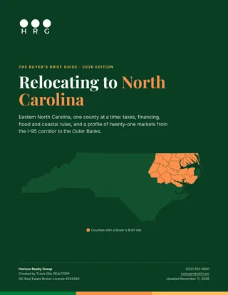
A free guide to moving here: what the move does to your taxes, how financing and flood rules change by county, how to choose between twenty-one eastern North Carolina markets, and a page on each one.
- The North Carolina tax picture, with the official source for every figure
- Loan limits, coastal permits and flood questions that change by county
- A side-by-side comparison of every market, then a profile of each
- A checklist for the first month in your new county