← Relocating to NC Carteret
Central Coast · County guide
Carteret County, North Carolina
“A barrier island, two harbor towns and the Down East communities, where the water sets the permits, the flood rules and the insurance quote.”
 By Travis Old, broker and builder. Drafted with Melinda, an AI assistant. How we write
The full Carteret County Buyer’s Brief site is not live yet. This page is a county guide in the meantime; listings and the full county briefs arrive with the site.
Carteret County runs along North Carolina's central coast, and a buyer here is choosing among three different kinds of ground. Bogue Banks is the barrier island that holds Emerald Isle, Indian Beach, Pine Knoll Shores and Atlantic Beach, and the unincorporated community of Salter Path alongside them. On the mainland are Morehead City, the town of Beaufort (the county seat, in Carteret County and not to be confused with Beaufort County), Newport, Cape Carteret and Cedar Point. Down East, east of the town of Beaufort, is a string of unincorporated communities along US 70 and NC 12, among them Harkers Island, Davis and Cedar Island. Access matters to all three. The county's history page dates the Cameron Langston Bridge, which carries traffic from the mainland to western Bogue Banks, to 1971, and says the original Atlantic Beach toll bridge opened in 1928 and passed to the State in 1934. The National Park Service says the islands of Cape Lookout National Seashore are reached only by boat, a private boat or one of the privately operated ferries (page read October 21, 2026).
The tax picture is a county rate plus a town rate plus, outside the towns, a fire district. Current county and town rates are in the table on this page; ask the county tax office for any district rate. Two other lines matter to a budget. The county levies a 6 percent room occupancy tax, which its Finance page says reaches individual rentals booked through platforms such as Airbnb and VRBO, with an exemption for stays of 90 consecutive days or more. And the beach itself has a price: the county's fiscal year 2025 audit shows a restricted beach nourishment balance of $42,318,101 at June 30, 2025, the Beach Commission voted on April 27, 2026 that each Bogue Banks town should contribute 25 percent of the cost of sand placed on its own beach (a commission motion; the records read through October 21, 2026 show no town or county adopting it), and unincorporated Salter Path carries its own beach nourishment tax district.
At a glance
- County property tax rate (FY2026-27)
- $0.225 per $100before any town rate
- Coastal (CAMA) permit county
- Yes
- Financing reference
- Conforming loan limit, one unit (2026)
- $832,750
- FHA loan limit, one unit (2026)
- $541,287
Tax rate: NCDOR, verified October 21, 2026; town rates and any district rates on file are in the table below. Loan limits: FHFA and HUD, verified November 3, 2026.
Flood status is where the island and the mainland differ most, and where dates matter. FEMA's Community Status Book, report date October 21, 2026, lists a future-dated map effective February 5, 2027 for Atlantic Beach, Beaufort, Morehead City, Newport and unincorporated Carteret, so the flood zone a buyer sees today on those parcels is the older map. Emerald Isle, Pine Knoll Shores, Cape Carteret, Cedar Point and Indian Beach have a map effective January 17, 2025, and the county says portions of unincorporated Carteret moved into a Coastal A zone on that date, where new construction and substantial improvements must meet V-zone standards. Community Rating System classes in the list effective October 1, 2026 run from Class 5 in Morehead City (25 percent) and Class 6 in Pine Knoll Shores (20 percent) through Class 7 in Beaufort, Emerald Isle and Cedar Point (15 percent) and Class 8 in Atlantic Beach, Newport and Cape Carteret (10 percent) to Class 9 for the unincorporated county (5 percent); Indian Beach, Bogue and Peletier have no class. FEMA says the discount applies to all National Flood Insurance Program policies in a participating community, inside or outside the mapped flood zone. On evacuation, the county names US 70, NC 101 and NC 58 as the three primary routes, towns issue their own re-entry permits, and the State Highway Patrol may temporarily close the bridges. Carteret is one of the 20 CAMA coastal counties, and the state's Division of Coastal Management presented a proposed Inlet Hazard Area change for Bogue Inlet to the Beach Commission on June 29, 2026; in the minutes read October 21, 2026 it was a proposal, not an adopted rule.
Beaufort is the historic-home market. Its Historic District was listed in the National Register on May 6, 1974, and the town separately regulates a local district of about 12 blocks that includes part of Taylor's Creek. In the local district the Historic Preservation Commission, which meets the first Tuesday of the month at 6 p.m. at the Train Depot, reviews exterior changes, new construction, relocations and demolitions, and under G.S. 160D-947 a certificate of appropriateness is required whether or not a building permit is. National Register listing alone adds no review. The state rehabilitation credit for a non-income-producing, State-certified historic structure is 15 percent of at least $10,000 in expenses, capped at $22,500 per parcel, once in any five-year period. Utilities decide a lot in this town: Beaufort's wastewater plant is permitted at 1.5 million gallons a day and the town manages sewer capacity by an allocation policy adopted January 11, 2021, so a vacant lot supposed to be on town sewer needs a written answer from the town. The town's pages were read October 22, 2026.
For land and custom builds, utilities and zoning vary parcel by parcel. The county's 2021 land use plan says only about 30 percent of the planning jurisdiction is zoned, all of it in the central and western parts. Down East instead has the Down East Conservation Ordinance, effective October 3, 2006, which sets a 45-foot mean roof height, an 80-foot lot width and minimum lot sizes of 10,000 to 20,000 square feet by land use class. Cape Carteret has no town water or sewer; Western Carteret Water Corporation, a private non-profit, supplies water and residential units use septic systems. Bogue Banks Water Corporation serves Emerald Isle, Indian Beach and Salter Path. County Environmental Health issues septic and well permits. Short-term rental rules sit in each town's code: Pine Knoll Shores' unified development ordinance (section 2.21) allows no more than two persons per bedroom and closes a house to short-term rental for a year after more than two violations in 12 months, while the Emerald Isle and Atlantic Beach use tables were not read. Read the town code before underwriting rental income.
| At a glance | The documented facts | Source |
|---|---|---|
| County property tax rate, FY2026-27 | $0.225 per $100 of assessed valuebefore any town, fire-district or service-district rate | NC Department of Revenue rate tables |
| Countywide reappraisal | Latest 2025; next scheduled 2029values are reset countywide in a reappraisal year | NC Department of Revenue rate tables |
| Town tax rates, FY2026-27 | Atlantic Beach $0.1525, Beaufort $0.2875, Bogue $0.05, Cape Carteret $0.14, Cedar Point $0.1175, Emerald Isle $0.11, Indian Beach $0.24, Morehead City $0.3425, Newport $0.455, Peletier $0.055, Pine Knoll Shores $0.165 per $100added to the county rate inside town limits | NC Department of Revenue rate tablesAs of November 12, 2026 |
| FEMA effective flood map dates | Future-dated February 5, 2027: Atlantic Beach, Beaufort, Morehead City, Newport, unincorporated county. January 17, 2025: Emerald Isle, Pine Knoll Shores, Cape Carteret, Cedar Point, Indian Beachcheck the effective and the preliminary maps for the parcel at NC FRIS | FEMA Community Status Book, report date October 21, 2026 |
| Community Rating System classes | Morehead City 5, Pine Knoll Shores 6, Beaufort 7, Emerald Isle 7, Cedar Point 7, Atlantic Beach 8, Newport 8, Cape Carteret 8, county 9Indian Beach, Bogue and Peletier are not in the program | FEMA CRS eligible communities list, effective October 1, 2026 |
| Room occupancy tax | 6% of gross receipts from room rentalsincludes platform rentals; stays of 90 consecutive days or more are exempt | Carteret County Finance, Occupancy Tax |
| Restricted beach nourishment balance | $42,318,101 at June 30, 2025General Fund restricted balance in the FY2025 audit | Carteret County, Annual Comprehensive Financial Report FY2025 |
| Primary evacuation routes | US 70, NC 101 and NC 58zone-based orders; each town issues its own re-entry permits | Carteret County Emergency Services, Evacuation |
| Local historic district | Beaufort, about 12 blocks including part of Taylor's CreekHistoric Preservation Commission meets the first Tuesday at 6 p.m.; certificate of appropriateness for exterior work | Town of Beaufort, Historic Preservation CommissionAs of October 22, 2026 |
| Septic and well permits | Carteret County Environmental Health, 3820 Bridges Street, Suite A, Morehead City252-728-8499 | Carteret County Environmental Health |
Sources
Read as of October 21, 2026, unless another date is shown.
Show all 14 sources
- Carteret County Tax Office: 2026 tax rates for the county and five towns, as of October 25, 2026
- NC Department of Revenue: county rates and reappraisal schedule, FY2026-27, as of October 22, 2026
- NC Department of Revenue: 2025-26 county and municipal rates, effective rates and special district rates, as of October 22, 2026
- FEMA Community Status Book Report, North Carolina, report date October 21, 2026
- FEMA CRS eligible communities list, effective October 1, 2026
- Carteret County Planning and Development: flood information and the January 2025 Coastal A zone
- Carteret County Finance: Occupancy Tax
- Carteret County: History of Bogue Banks (bridges)
- North Carolina Session Laws: S.L. 2007-112, Carteret County occupancy tax, Tourism Development Authority and Beach Commission, as of October 22, 2026
- Town of Beaufort: Historic Preservation Commission (local district of about 12 blocks), as of October 22, 2026
- N.C. Gen. Stat. 160D-947: certificate of appropriateness required, as of October 22, 2026
- N.C. Gen. Stat. 105-129.106: credit for rehabilitating a non-income-producing historic structure, as of October 22, 2026
- National Park Service: Cape Lookout National Seashore directions
- NC School Report Cards (NC Department of Public Instruction), as of October 22, 2026
A builder’s observations
If you plan to build or renovate here
One owner, two companies. Travis Old is a licensed North Carolina real estate broker with Horizon Realty Group and the President of Two Sons Construction, LLC, a licensed general contractor. You are never required to use one to work with the other. Two Sons Construction works in Carteret County. Two Sons Construction has its own line, (252) 565-1900.
Flood elevation shapes the design
Near the water, the base flood elevation sets the finished floor height, the foundation type and part of the insurance premium. It is worth asking for an existing elevation certificate. A substantial renovation can require bringing an older house up to current flood rules, and a CAMA permit can also apply near the water.
If the house is in a historic district
If the address is inside a locally designated historic district, exterior work usually needs a Certificate of Appropriateness before it starts, and windows, siding, roofing, porches and fences can all be reviewed. A National Register listing on its own does not usually bring that review. Ask the town which applies to your address before pricing the work.
Permits and zoning vary by jurisdiction
Setbacks, lot coverage and permit timelines differ between a county and the towns inside it. Confirm them with the planning office before a design is priced.
General observations for this kind of county, not advice about a particular property. Rules change. Confirm each one with the office that administers it.
When the site launches
Tell me when the Carteret County site launches
One email when the Carteret County Buyer’s Brief goes live, and sooner if Travis can already help with your search.
Neighboring counties
- CravenTwo rivers, a locally regulated historic downtown and a Marine Corps air station, with flood history that is on the public record.County guide
- OnslowThe county of Camp Lejeune and MCAS New River, where the housing allowance is a rent figure rather than a purchase budget, plus the north end of Topsail Island with its own inlet and flood questions.County guide
- PamlicoA sailing harbor and a small-town county on the Neuse and Pamlico waters, where flood elevation, sewer and a pending reappraisal decide the numbers.County guide
- HydeThe waterfowl coastBrief site
The free guide
Relocating to North Carolina
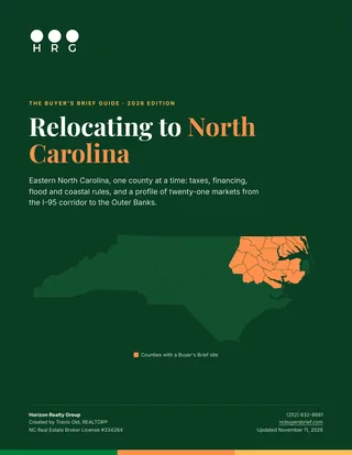
A free guide to moving here: what the move does to your taxes, how financing and flood rules change by county, how to choose between twenty-one eastern North Carolina markets, and a page on each one.
- The North Carolina tax picture, with the official source for every figure
- Loan limits, coastal permits and flood questions that change by county
- A side-by-side comparison of every market, then a profile of each
- A checklist for the first month in your new county